Available with any of the following subscriptions:
- All plans
Definition
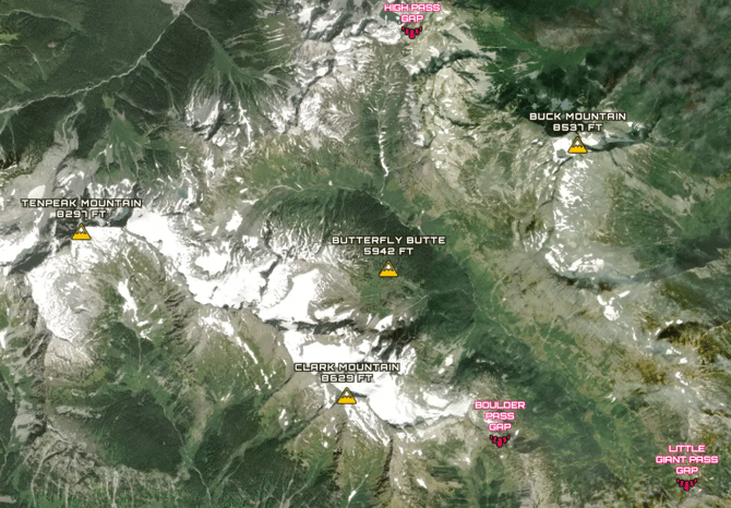
Our Summits and Gaps overlay represents the official names of mountain peaks and passes in the United States. It is derived from the Geographic Names Information System (GNIS); the Federal and national standard for geographic nomenclature. The U.S. Geological Survey's National Geospatial Program developed the GNIS in support of the U.S. Board on Geographic Names as the official repository of domestic geographic names data, the official vehicle for geographic names used by all departments of the Federal Government.
Key Benefits
- A great visual reference for showcasing views to a prospective buyer
- Useful high-level context for property locations
Tip: Label includes the name of the summit or gap, as well as the summit elevation in feet.
Limitation: GNIS data is generally considered to be accurate, though errors in naming and positional precision can occur.
Coverage
United States of America
Update Frequency
As updates are available