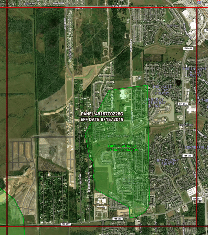
FEMA Panels and LOMRs Overlay
Learn about the FEMA Panels and LOMRs Overlay, including the definition, benefits, tips, coverage and update frequency.
Available with any of the following subscriptions:
- All plans
Definition
FEMA Panels, also known as Flood Insurance Rate Map (FIRM) panels, are divisions of FEMA Flood Insurance Rate Maps.
A Letter of Map Revision (LOMR) is an official document issued by FEMA to modify or revise information on FEMA maps. LOMRs can be issued for various reasons, including changes to topography, hydrology or the construction of flood control structures. LOMRs are used to update and reflect more accurate flood risk information, and they play a crucial role in helping communities manage floodplain development and insurance requirements based on current conditions.

Key Benefits
-
FEMA Panels, integral parts of Flood Insurance Rate Maps (FIRMs), serve as essential references for communities and individuals to understand flood risk. They provide detailed information about flood hazard zones, elevations and other factors, aiding in informed decision-making related to land-use planning, insurance requirements and disaster preparedness.
-
LOMRs are critical tools for keeping flood hazard information up-to-date. When changes occur in topography or infrastructure, LOMRs are issued by FEMA to revise and improve floodplain maps. These revisions help communities adapt to evolving conditions, manage development in flood-prone areas and ensure accurate insurance requirements based on the latest data, enhancing overall resilience against flooding.
Tip: Labels contain panel and LOMR ID numbers and effective dates.
Limitations: This layer should be used for reference only. Users should be cautious of potential temporal lags in updates and positional precision errors.
Coverage
United States of America
Update Frequency
Biannually