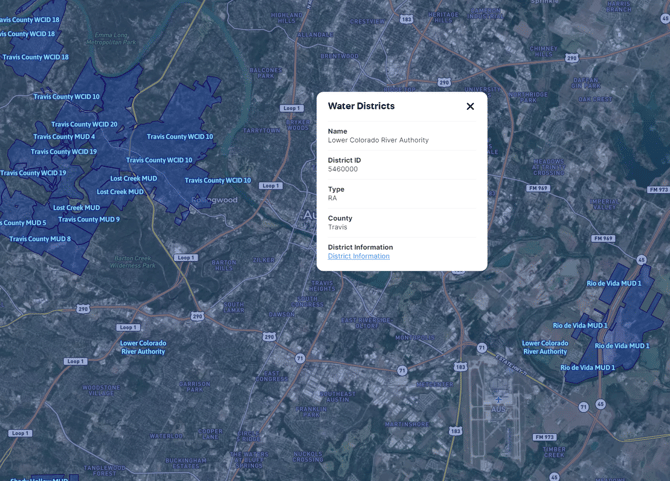
Water Districts Overlay
Learn about the Water Districts Overlay, including the definition, benefits, tips, coverage and update frequency.
Available with any of the following subscriptions:
- All plans
Definition
This overlay shows the boundaries of water conservation districts for each represented state.

Key Benefits
This overlay is useful for land development planning and general water development and conservation efforts.
Tip: Click on the overlay to see a pop-up with information including the name, district id, type, county, and district information link.
Limitation: This product is for informational purposes and may not have been prepared for or be suitable for legal, engineering or surveying purposes. It does not represent an on-the-ground survey and represents only the approximate relative location of property boundaries.
Coverage
California, Texas
Update Frequency
Annually