
Available with any of the following subscriptions:
- All plans
Definition
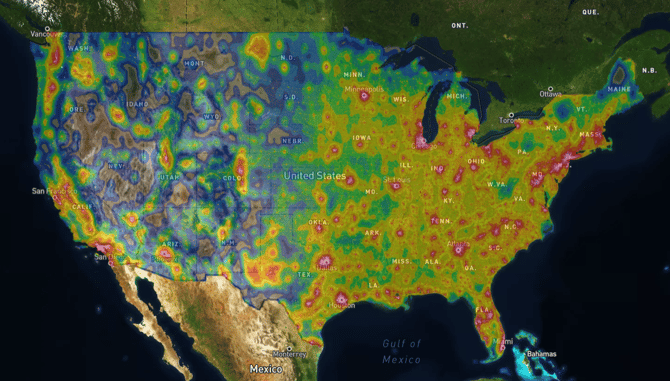
The Light Pollution Overlay is built from NASA/NOAA satellite imagery that measures how much artificial light is visible from space each night. Rather than simply reading the brightness at a single point on the map, the score also accounts for the surrounding glow from nearby towns and cities — the kind of diffuse sky brightness that washes out stars even when you're standing well outside city limits.
With our large range of brightness graduations, the difference between a genuinely pristine sky and a merely "pretty dark" one is clearly visible on the map so you can find the darkest night sky possible.
Key Benefits
- Locate areas with the least amount of light pollution possible
- Compare locations across the full range of dark skies
- Identify areas with the highest quality rural recreation
- Research the level of human activity and disturbance near your property of interest
Limitation: The Light Pollution Overlay is available on the desktop version of Land id only.
Coverage
United States of America
Update Frequency
As updates are available